

Located at the Southwestern tip of the island of Mauritius in the Indian Ocean you will find a fascinating illusion. It is caused by the trails of sand on the sea floor being dragged away by water going between the opening in the reefs (La Passe). When viewed from above, the runoff of sand and silt deposits creates the incredibly spectacular impression of an 'underwater waterfall'.
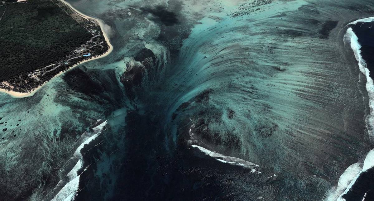
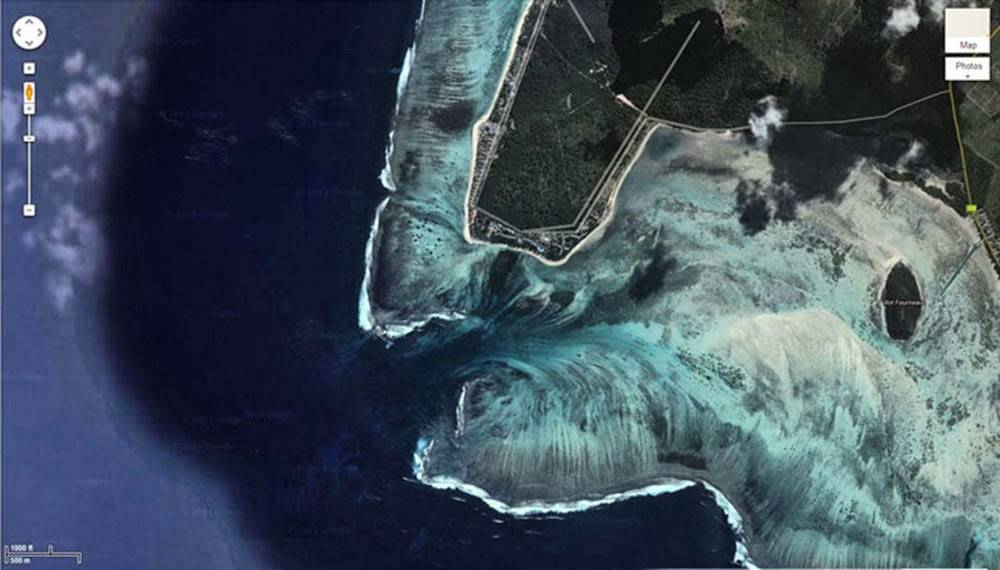
Satellite views (such as the Google Map screenshot below) are equally dramatic, showing an underwater vortex seemingly appearing off the coast of this tropical paradise.
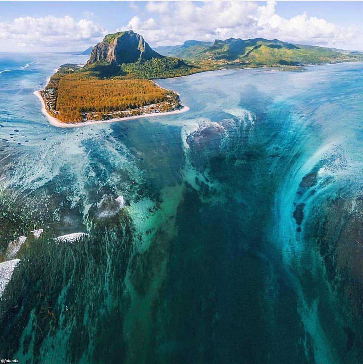
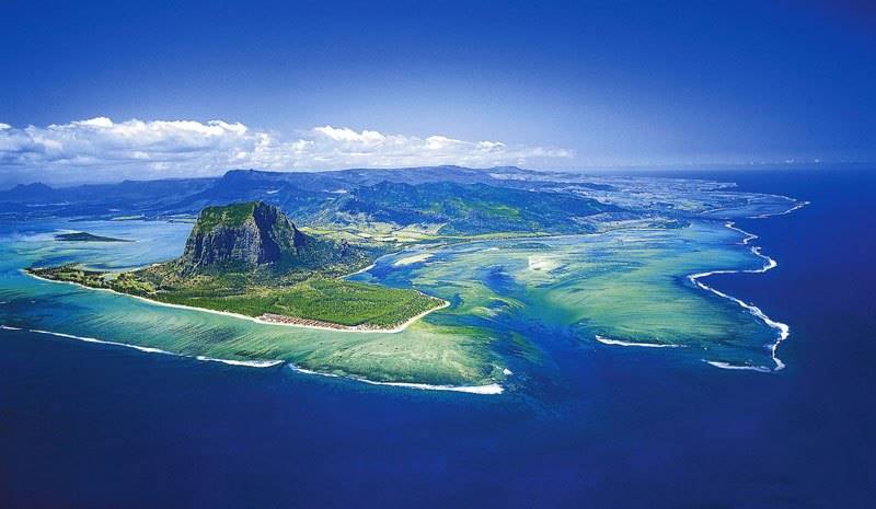
Towering high above is Le Morne Brabant, a basaltic monolith with a summit 556 m (1,824 ft) above sea level. The summit covers an area of over 12 hectares (30 acres) and is situated on Le Morne Brabant peninsula. The area (Le Morne Cultural Landscape) is recognized by UNESCO as a World Heritage Site.
Protected by its isolated, wooded and almost inaccessible cliffs, in the 18th and early 19th centuries runaway slaves formed small settlements in the caves and on the summit of the rugged mountain.
Photograph via The St. Regis Mauritius ResortRecently, videographer ReubenMRU flew his drone high above the island to show what Le Morne Brabant and the nearby 'underwater waterfall' look like from above.
